Home Icy Strait Point to Hoonah

Walking + shuttle guide

Icy Strait Point to Hoonah

Can you walk from Icy Strait Point to Hoonah? Yes. Here's the exact distance, real walking time, terrain, elevation, landmarks, accessibility notes, shuttle details, and a map — everything you need to plan the walk instead of guessing at it.

~1.5 miOne-way distance
25–45 minWalking time, one way
FlatElevation change
PavedPath surface, uneven in spots
~5 minShuttle ride

Can you walk from Icy Strait Point to Hoonah?

Yes. A shoreline path connects the Icy Strait Point cruise dock to downtown Hoonah, following the shoreline and Cannery Road for about 1.5 miles. It's flat the entire way. Most people cover it in 25–45 minutes depending on pace and how often they stop for photos. A shuttle also runs whenever a ship is in port, for anyone who'd rather ride one or both directions.

The rest of this guide breaks the walk into the four things people actually ask about: what the ground is like underfoot, what you'll see along the way, who should consider the shuttle instead, and how much time to leave for the return.

The route

A map of the walk

This is a schematic route diagram, not a satellite image — it's built to show the order of landmarks and the shape of the walk clearly. Use it alongside the mile-by-mile guide below.

Route map from Icy Strait Point to downtown Hoonah A stylized shoreline path running roughly 1.5 miles from the Icy Strait Point cruise dock, past the donut shack, ticket booth, brewery, Shaman Point viewpoint, and the Old Bear Clan Cemetery, into downtown Hoonah harbor. ISP DOCK Donut shack & ticket booth Brewery / shuttle return stop Shaman Point viewpoint Old Bear Clan Cemetery "Welcome to Hoonah" sign DOWNTOWN HOONAH
Start / end points Landmarks along the way ≈ 1.5 miles total, following the shoreline and Cannery Road

Mile by mile

Landmarks along the way

You're never more than a few hundred yards from a landmark on this walk, which makes it easy to judge your pace. Here's the order, ship to town.

0.0 mi

Where the walk starts

From the ship, follow the boardwalk signs for "town" past the Icy Strait Point donut shack toward the ticket booth. The Hoonah shuttle stop is just past the ticket booth if you want to ride instead — tickets are sold there, not on the bus.
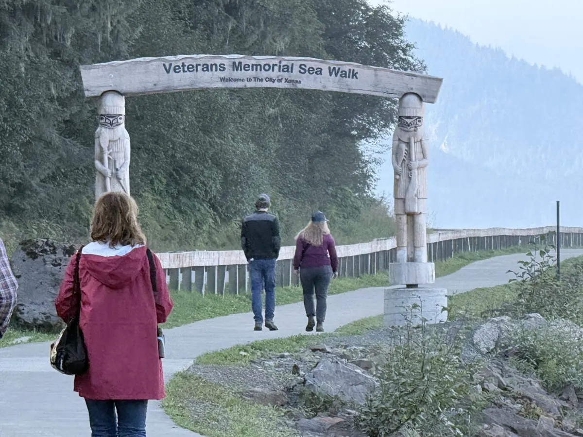
The carved totem archway marking the start of the Veterans Memorial Sea Walk, with walkers passing underneath
The Veterans Memorial Sea Walk archway, where the walk begins.
0.2 mi

Onto the shoreline path

The walking path runs alongside the same road the shuttle uses, with open water to one side and the mountain to the other. The surface is paved, though it's patched and uneven in places from erosion — watch your footing rather than the view for the first stretch.
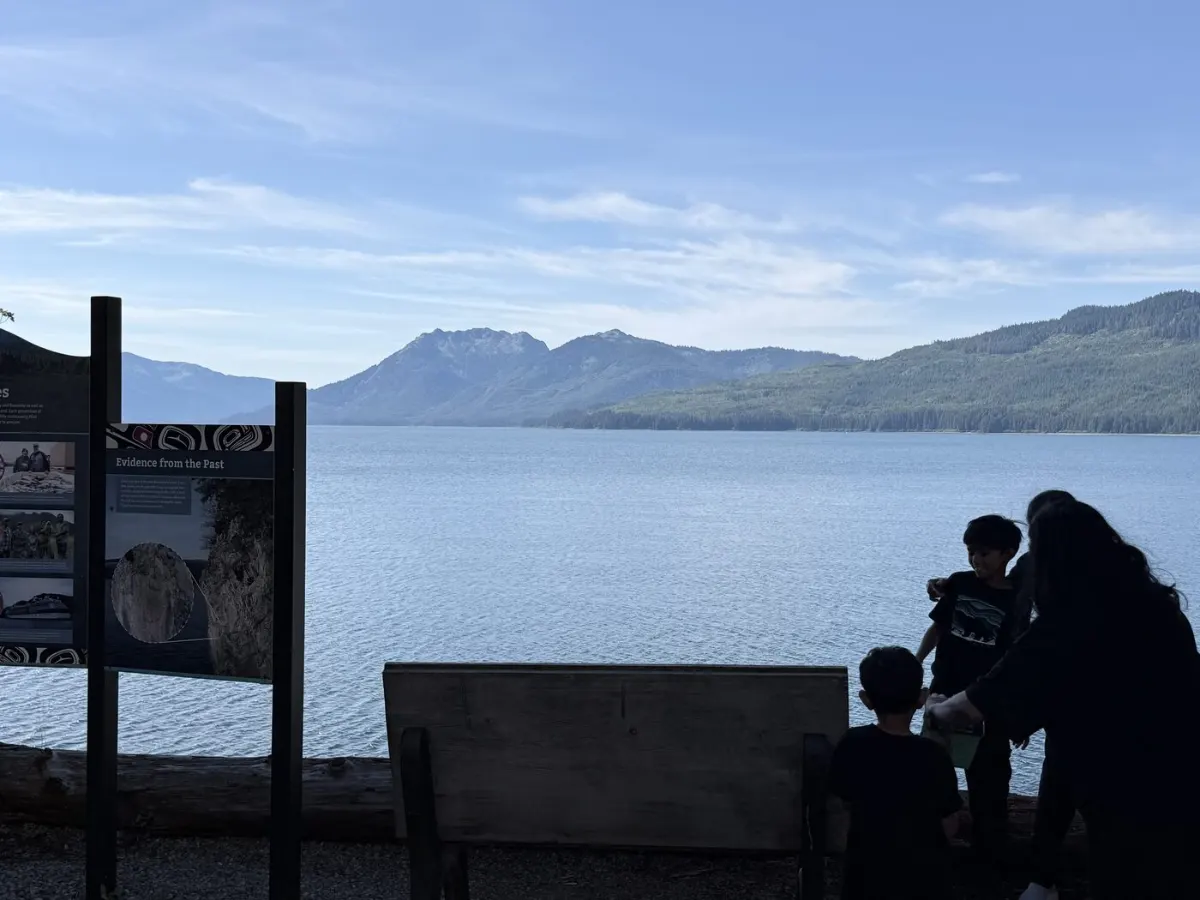
Open water and mountains along the shoreline path between Icy Strait Point and Hoonah
The view along the shoreline path — open water on one side, mountains on the other.
0.6 mi

Shaman Point viewpoint

A natural pause point along the water. Bald eagles are commonly seen perched nearby, and this stretch is a good spot to scan the strait for breaching whales.
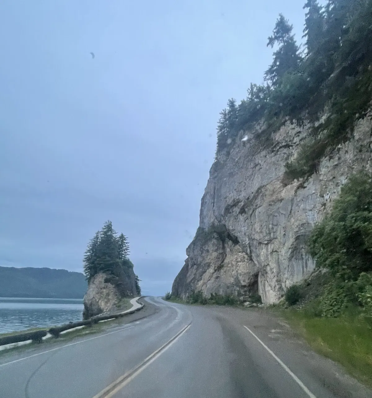
Shaman Point, a dramatic rock outcrop along the shoreline road between Icy Strait Point and Hoonah
Shaman Point, the rock outcrop that gives this viewpoint its name.
0.8 mi

Hoonah Veterans Memorial Sea Walk marker

This stretch of path is officially named the Hoonah Veterans Memorial Sea Walk. Partway along, a "Remember the Fallen" memorial honors two Hoonah Police Department officers, alongside "Hoonah Through the Ages" interpretive panels covering the town's history — worth the two-minute pause even if you're not stopping anywhere else.
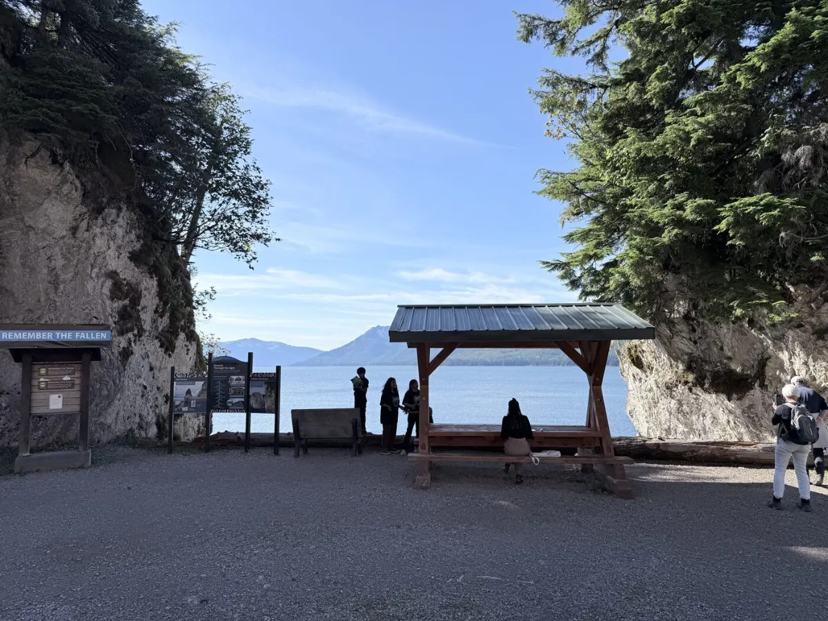
Remember the Fallen memorial and Hoonah Through the Ages history panels along the Hoonah Veterans Memorial Sea Walk, overlooking the strait
The Remember the Fallen memorial and Hoonah Through the Ages history panels, overlooking the strait.
1.0 mi

Old Bear Clan Cemetery

A quiet, historic Tlingit clan cemetery near the edge of town. Walk past respectfully; it's a residential and cultural site, not a tourist stop.
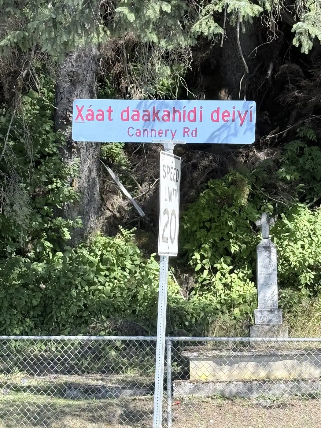
The Cannery Road sign in Tlingit and English near the historic cemetery
The Cannery Road sign, in Tlingit and English, near the cemetery.
1.3 mi

"Welcome to Hoonah" sign

A green road sign with a white arrow marks the entrance to town, followed by an older concrete retaining wall. This is the clearest visual cue that you've arrived.
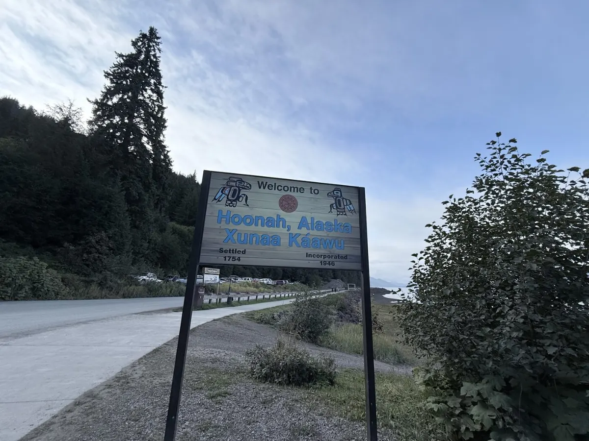
The Welcome to Hoonah, Alaska Xunaa Kaawu road sign marking the entrance to town
The “Welcome to Hoonah” sign marking the entrance to town.
1.5 mi

Downtown Hoonah harbor

The path opens into downtown, right along the working harbor. From here, everything — restaurants, shops, tour meeting points — is a short walk. See our full things-to-do guide for what to do once you're here.
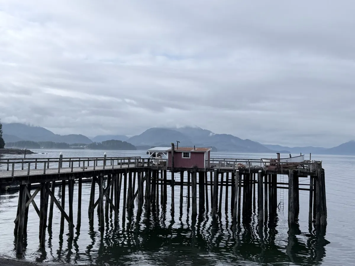
A weathered dock on pilings in Hoonah's harbor, with mountains across the strait
Hoonah’s working harbor, near where the walk ends downtown.

Practical details

Terrain, elevation & conditions

Surface

Mostly paved concrete path/boardwalk paralleling the road. Some sections are patched or broken from erosion, and can get muddy where the pavement gives way, especially after rain.

Elevation

Flat the entire way. There is no meaningful climb in either direction — the route follows the shoreline at sea level.

Accessibility

Not a certified accessible trail. The grade is flat, but uneven, patched pavement and erosion mean wheelchair users and anyone with mobility limitations should plan on the shuttle rather than the walk.

Stroller suitability

Workable in dry weather with an all-terrain or jogging stroller; a standard umbrella stroller will struggle with the rougher patches. Skip it in the rain, when sections get muddy.

Weather

Hoonah is a rainforest town. Rain is common throughout the cruise season and increases sharply by September. Pack a rain shell and waterproof footwear regardless of the forecast at departure.

Wildlife you may see

Bald eagles are common along the entire route. Whales are sometimes visible breaching out in the strait. Bears are not typically encountered on this walk, but this is bear country — stay alert and never approach wildlife.

Not walking?

Shuttle information

Ride timeAbout 5 minutes each way
RunsWhenever a cruise ship is in port
CostTwo shuttle services now run between the dock and town; a round-trip ticket typically runs $8–10 depending on which one you catch. Small local shuttle pricing can change without notice, so confirm at the ticket booth the day you're in.
Where to buyTicket booth at Icy Strait Point, near the donut shack — not sold on board the shuttle itself.
Return pickupIn front of the Icy Strait Point brewery, on the Hoonah end of the route.

A common plan: walk one direction for the views and scenery, then take the shuttle back if you're short on time or the weather turns.

After the walk

Three local ways to spend the rest of your port day

You made it to town. These are the three stops visitors ask about most. All three are independent businesses run by people who live in Hoonah, and you can book or call them direct.

See brown bears

Wild Bear Safari runs small-group bear viewing tours from Hoonah, capped at 10 guests. Plan on 3-4 hours.

Book Wild Bear Safari

Go whale watching

Whales of Xunaa takes up to 6 guests on a 27-foot former Alaska State Trooper Safeboat.

Book Whales of Xunaa

Eat lunch on the harbor

The Fisherman's Daughter is a family-run harborfront restaurant at 357 Harbor Way, serving fresh local seafood and breakfast.

Get directionsCall

Restrooms

Use the restrooms at Icy Strait Point before you set out. There are also public restrooms near the ferry port, about two-thirds of the way along the shoreline walk. In downtown Hoonah, restrooms are available at the harbor area, beside City Hall, and at participating local businesses such as restaurants. Hours can vary, so ask a nearby business if one is closed. The Hoonah map shows every restroom pin.

What to do once you're in town

Restaurants, shops, tour meeting points, and Tlingit culture sites are all within a short walk of the harbor. See the full things-to-do guide.

Time to allow for the return

Build in at least 45–60 minutes before your ship's all-aboard time to walk back or catch the shuttle, especially in rain or if you're unsure of the shuttle's last run. Independent Hoonah operators plan tightly around ship schedules, but the walk and shuttle are on you to time.

Quick answers

Frequently asked questions

Can you walk from Icy Strait Point to Hoonah?

Yes. A flat, roughly 1.5-mile shoreline path connects the two, typically covered in 25–45 minutes.

How long does it take to walk from Icy Strait Point to Hoonah?

Most people take 25–45 minutes one way at a comfortable pace with a few photo stops. A brisk, no-stops pace can cover it in about 20–25 minutes.

Is there a shuttle between Icy Strait Point and Hoonah?

Yes, whenever a ship is in port. It's about a 5-minute ride, typically sold as a round-trip ticket at the Icy Strait Point ticket booth.

Is the walk stroller- or wheelchair-friendly?

The route is flat, but the paved surface is uneven and patched in places and can get muddy in rain. It's workable with an all-terrain stroller in dry weather; wheelchair users and anyone with mobility limitations should plan on the shuttle instead.

Can you see wildlife on the walk?

Bald eagles are common along the route, and whales are sometimes visible breaching in the strait. Bear encounters on this specific walk are not typical, but you're in bear country, so stay alert.

How often does the shuttle run?

There's no printed schedule — it runs continuously back and forth whenever a ship is in port. Some travelers report catching one right away; others have waited closer to 20–30 minutes between buses. Build in some buffer rather than assume one's waiting the moment you reach the stop, especially on a tight port day.

Can you buy a one-way shuttle ticket, or is it round-trip only?

Tickets are sold at the Icy Strait Point ticket booth, not on the bus, and travelers have consistently reported that only round-trip tickets are sold there — there's no ticket booth in Hoonah to buy a one-way fare for the ride back. If there's any chance you'll want the shuttle in either direction, buy the round-trip ticket before you set out rather than plan to sort it out in town.

Is it safe to walk from Icy Strait Point to Hoonah because of bears?

Chichagof Island has one of the highest brown bear densities in Alaska, so yes, it's bear country. That said, the walk itself follows a paved path directly alongside the shuttle road, not a backcountry trail, and bear encounters on this specific route aren't typical — most bear sightings happen on dedicated viewing tours away from the road. Stay alert, skip the headphones, and give any wildlife you do see plenty of space.

Exactly how far is the walk — is it 1.5 miles?

Most accounts land in the same neighborhood: roughly 1.3 to 1.5 miles one way, with a few older reports citing closer to 2 miles. The route hasn't changed — the differences come down to where each person started measuring from (the ship, the cannery, or the ticket booth) and whether they rounded. Plan on about 1.5 miles and 25–45 minutes each way and you won't be caught off guard.

By cruise line

Cruising with a specific line?

Each line docks, schedules and times its port day a little differently. Pick yours for the details: Celebrity, Disney Cruise Line, Holland America, Norwegian, Princess and Royal Caribbean.

Free for the Shore Crew

Get the Hoonah Port Day Cheat Sheet

One printable page with walk times, shuttle tips, landmarks, and a back-to-ship clock so you never cut it close. Join The Shore Crew and it lands in your inbox. One email a month, no fluff.

Now plan the rest of your day

See what's actually worth doing once you're in town, or how Hoonah compares to staying at the port. Still have questions? See the real questions cruise passengers ask.